|
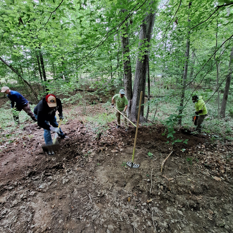
Thanks to Turn5's sponsored "Extreme Terrain Clean Trail Cleanup" grant which was awarded to us, we were able to purchase 3 new Rogue trail rake tools. Trail work to build and maintain our trails at Pocahontas takes help from volunteers but with tools in their hands! Thanks Turn5! Volunteers using the new Rogue trail rakes for finish work on a new hiking trail at Pocahontas State Park
0 Comments
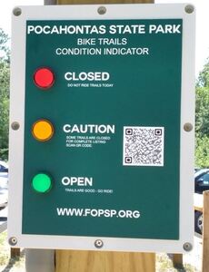
This is a frequent question we see, many times on social media and also in messages we receive. If you are a new trail user, you might be surprised to find out we close trails sometimes due to weather. Our biking (and hiking) trails can be damaged when used during wet conditions. To lessen damage and prevent unnecessary repair work, we follow the guideline of closing the trails for 24 hours for every 1 inch of precipitation. PSP trail riders, we’ve made it easy to check the status of mountain bike trails at Pocahontas State Park. (Always check status before you ride!)
As you may have noticed, the trail system has expanded in a big way at Pocahontas in the last 5 years. As a result, users are finding access to the park through multiple parking area options including the "satellite" lots on the perimeter of the park. Some of these parking lots have a payment box to purchase a day parking ticket but some do not. As an option, you can purchase an annual pass for Pocahontas online for only $75.00. The parking pass will allow you entrance into the park at any attended entrance and also at approved perimeter parking locations.
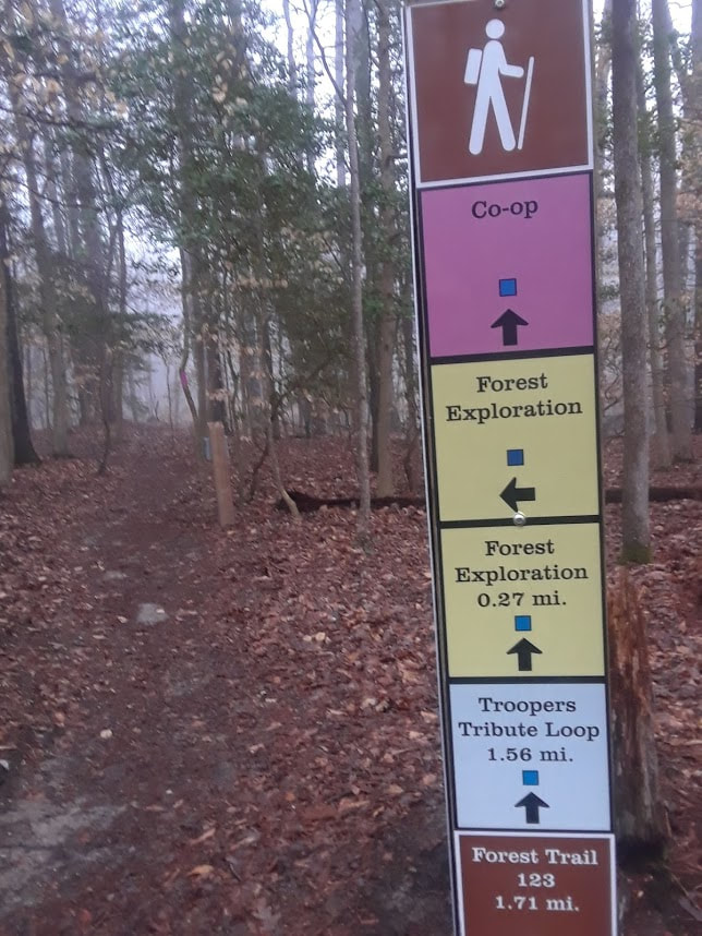
You can purchase an annual pass here. Did you know that trails have ratings to define the difficulty level? If you have ever snow skied before, you will recognize these symbols, but if not, after this short read you will! Hiking and biking trail developers have adopted the same symbols used for ski trails to quickly identify the relative difficulty of a trail in a trail system, ranging from "Easiest" to "Most Difficult". The level of the trails in a system are defined based on all other trails in that system - this is an important point to realize as an "Easiest" trail in one system may not be the same as another "Easiest" trail in another system; however it should give a user a good point of reference for which trail to ride based on his/her ability.  Easiest trails tend to have few or no obstacles, are relatively flat and wide, and have the shortest distances in a system. This is a great place for the novice to start. Easiest trails are marked with a green circle symbol. Intermediate trails tend to have more obstacles that have to be maneuvered over, slightly narrower and longer, with more elevation change. Intermediate trails are marked with a blue square. Most-Difficult trails are also referred to as "Expert" level and will be the most narrow, more elevation change and have obstacles that cannot be avoided. In the case of bike trails, some trails may have jumps, logs and other features that will put a rider off the ground. Users should not attempt this type of trail if not already comfortable riding Intermediate level trails. Expert level trails are marked with either a single black diamond or multiple black diamond for "extra" difficult trail definition. Back for 2020, the enduro-style mountain bike race known as POCA GO! is scheduled for August 15, 2020. For more information and registration, see here: https://www.bikereg.com/poca-go2020#Notes
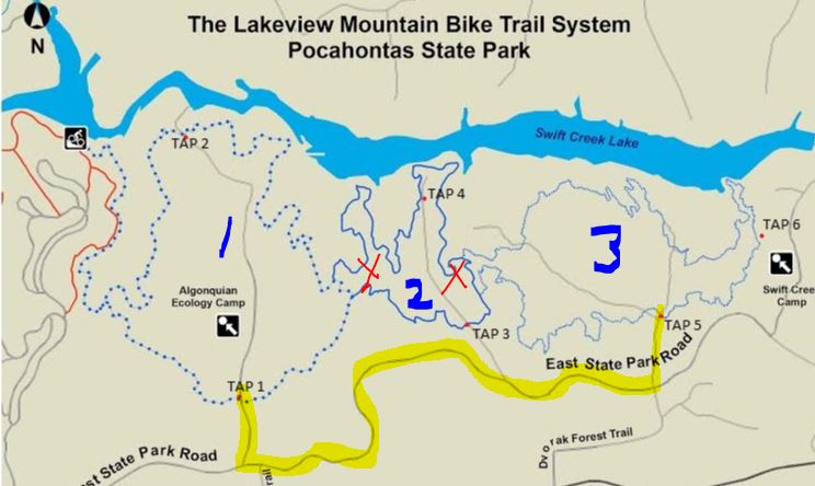
Effective Now - the Lakeview Too (2) trail will be closed entirely for construction of new cabins. The trail is closed for reasons of safety due to heavy equipment operating in this area. Once construction is completed, a reroute will be put in place to re-establish as much of the original trail as possible. The cabins are part of the 30 year Master Plan for Pocahontas State Park. Users can access Lakeview 1 and Lakeview 3 loops and use a portion of East State Park Rd to connect.
Detour details: Use East State Park Rd or Fendley Station fireroad to connect Lakeview 1 (see Tap 1 point) to Lakeview 3 (see Tap 5 point), highlighted below: Pocahontas State Park holds annual closures to help maintain the deer population. Please note that all areas of the park south of Beach Road, including Bright Hope Horse Complex, will be closed Nov. 7-10 for a managed deer hunt. The entire park will be closed Dec. 4th-6th and 18th-20th for managed deer hunts.
For more information, see http://www.dcr.virginia.gov/state-parks/pocahontas#general_information If you've been watching our trail conditions you might be wondering why some of our trails are closed when others might be open? This time of the year can be problematic for certain trails, especially newer "built" trails. Some of the bike trails at Pocahontas are currently closed due to what's known as freeze-thaw conditions. When there's moisture in the ground and then deep-freezing temperatures occur, the trail surface heaves up with ice crystals and is very fragile. Any traffic on the surface will cause rutting and deformation of the trail which can ruin it and make a mess!
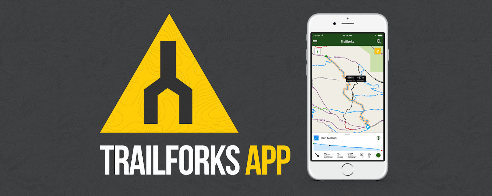
Our trail builders and volunteers ask that you respect the closures to protect the trails from damage so that we can all enjoy riding instead of repairing! See www.fopsp.org for more details. If you're looking for the latest trail app available with great map detail and tons of features, check out the Trailforks mobile app. This free app not only has detailed maps for virtually any trail system in North America (including Pocahontas SP!), it also has features that allow users to report trail issues, plan rides, and it can also be connected to Strava. www.trailforks.com/apps/map/ |




 RSS Feed
